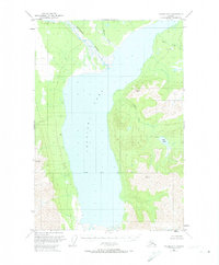
1949 Map of Valdez D-7
USGS Topo · Published 1974About this map
Tazlina Lake dominates this 1949 interior landscape, serving as the central reservoir for the surrounding glacial runoff and drainage networks. The glacial Nelchina River enters from the north, depositing sediment into the broad basin before the waters eventually progress toward the Copper River system. The map reveals a wild, largely unsettled region during the late 1940s, where the only signs of human habitation are isolated Cabins scattered along the shoreline and western slopes.
Find a feature on this map
5 named features on this map. Tap any name to fly to it.
Don’t see what you’re looking for? This feature index may not catch every label — zoom into the map to look around manually.
Map Details
Editions of this 1949 Valdez D-7 Map
3 editions found
Other maps of this area

1949 · Gulkana A-5
USGS Topo · 1:63,360

1949 · Gulkana A-6
USGS Topo · 1:63,360

1949 · Valdez D-8
USGS Topo · 1:63,360

1949 · Valdez D-6
USGS Topo · 1:63,360

1949 · Valdez D-7
USGS Topo · 1:63,360

1950 · Valdez C-6
USGS Topo · 1:63,360

1951 · Gulkana
USGS Topo · 1:250,000

1951 · Valdez D-6
USGS Topo · 1:63,360

1951 · Valdez D-7
USGS Topo · 1:63,360

1952 · Valdez D-8
USGS Topo · 1:63,360