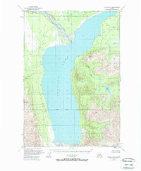
1949 Map of Valdez D-7
USGS Topo · Published 1974About this map
Tazlina Lake dominates this glacial landscape, serving as a central catchment for the surrounding mountain drainages during the late 1940s. The Nelchina River flows into the northern reaches of the lake, where a complex delta system highlights the shifting hydrology of the region. Scattered cabins along the shoreline and interior waterways suggest a pattern of seasonal subsistence or remote outposts in an era before established road networks reached this interior basin. To the east, the terrain rises toward High Lake, with several significant tributaries including Mendeltna Creek, Kaina Creek, and Tokaina Creek cutting through the uplands. The survey also documents the Copper River Base Line, a critical surveying benchmark for land management in this part of the Alaskan territory.
Find a feature on this map
10 named features on this map. Tap any name to fly to it.
Don’t see what you’re looking for? This feature index may not catch every label — zoom into the map to look around manually.
Map Details
Editions of this 1949 Valdez D-7 Map
3 editions found
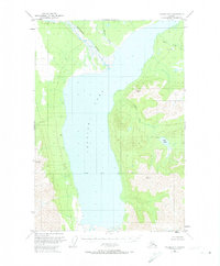
Other maps of this area

1949 · Gulkana A-5
USGS Topo · 1:63,360

1949 · Gulkana A-6
USGS Topo · 1:63,360

1949 · Valdez D-8
USGS Topo · 1:63,360

1949 · Valdez D-6
USGS Topo · 1:63,360

1949 · Valdez D-7
USGS Topo · 1:63,360

1950 · Valdez C-6
USGS Topo · 1:63,360

1951 · Gulkana
USGS Topo · 1:250,000

1951 · Valdez D-6
USGS Topo · 1:63,360

1951 · Valdez D-7
USGS Topo · 1:63,360

1952 · Valdez D-8
USGS Topo · 1:63,360