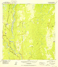
1952 Map of Gulkana A-3
USGS Topo · Published 1952About this map
The Copper River dominates this mid-century landscape where major Alaskan transportation corridors intersect. In the early 1950s, the junction of the Glenn Highway and the Richardson Highway served as a critical node for travel and logistics. Aviation infrastructure is prominent with the Gulkana Airfield and its associated C A A Station, reflecting the importance of air travel in the territory's development.
Find a feature on this map
16 named features on this map. Tap any name to fly to it.
Don’t see what you’re looking for? This feature index may not catch every label — zoom into the map to look around manually.
Map Details
Editions of this 1952 Gulkana A-3 Map
2 editions found
Other maps of this area

1948 · Valdez D-5
USGS Topo · 1:63,360

1949 · Gulkana A-3
USGS Topo · 1:63,360

1949 · Valdez D-4
USGS Topo · 1:63,360

1949 · Gulkana B-2
USGS Topo · 1:63,360

1950 · Gulkana B-3
USGS Topo · 1:63,360

1951 · Valdez D-5
USGS Topo · 1:63,360

1951 · Gulkana
USGS Topo · 1:250,000

1951 · Gulkana A-4
USGS Topo · 1:63,360

1951 · Gulkana B-4
USGS Topo · 1:63,360

1952 · Gulkana A-3
USGS Topo · 1:63,360