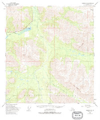
1950 Map of Nabesna D-5
USGS Topo · Published 1995About this map
The Mentasta Mountains dominate the southern reach of this sub-arctic landscape, providing a formidable backdrop to the drainage systems of the Little Tok River and various glacial tributaries. As documented in the late 1940s and early 1950s, the area reflects a transitional phase of interior Alaskan infrastructure, where the modern Glenn Highway intersects with older pathways like the Old Indian Trail.
Find a feature on this map
18 named features on this map. Tap any name to fly to it.
Don’t see what you’re looking for? This feature index may not catch every label — zoom into the map to look around manually.
Map Details
Editions of this 1950 Nabesna D-5 Map
3 editions found

Other maps of this area

1948 · Tanacross A-6
USGS Topo · 1:63,360

1948 · Tanacross A-4
USGS Topo · 1:63,360

1948 · Nabesna C-6
USGS Topo · 1:63,360

1948 · Nabesna D-5
USGS Topo · 1:63,360

1948 · Tanacross A-5
USGS Topo · 1:63,360

1949 · Tanacross
USGS Topo · 1:250,000

1949 · Nabesna D-6
USGS Topo · 1:63,360

1949 · Tanacross A-5
USGS Topo · 1:63,360

1950 · Tanacross
USGS Topo · 1:250,000

1950 · Nabesna
USGS Topo · 1:250,000