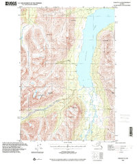
1993 Map of Valdez C-6
USGS Topo · Published 2001About this map
Klutina Lake dominates this glacial landscape, serving as the massive terminus for the Klutina River which flows northward through the valley floor. Compiled from mid-century topography with updated planimetry from 1993, the map illustrates a wilderness largely defined by its dramatic elevation changes and alpine water systems. High peaks such as Powell Peak and Dyke Mtn overlook the lake, while the southern reaches are fed by the Hallet River. Evidence of human presence is sparse, limited to a single Cabin and various primitive trails, suggesting a region primarily utilized for seasonal subsistence or remote exploration. The vast Cranberry Marsh in the north indicates the saturated, low-lying terrain that borders the lake's outlet. This survey documents the unchanging nature of the Copper River Meridian before modern development reached these remote corridors.
Find a feature on this map
13 named features on this map. Tap any name to fly to it.
Don’t see what you’re looking for? This feature index may not catch every label — zoom into the map to look around manually.
Map Details
Editions of this 1993 Valdez C-6 Map
This is the sole edition of this map. No revisions or reprints were ever made.
Other maps of this area

1948 · Valdez D-5
USGS Topo · 1:63,360

1949 · Valdez D-6
USGS Topo · 1:63,360

1949 · Valdez D-7
USGS Topo · 1:63,360

1950 · Valdez C-6
USGS Topo · 1:63,360

1951 · Valdez D-5
USGS Topo · 1:63,360

1951 · Valdez D-6
USGS Topo · 1:63,360

1951 · Valdez D-7
USGS Topo · 1:63,360

1951 · Valdez B-5
USGS Topo · 1:63,360

1951 · Valdez C-5
USGS Topo · 1:63,360

1951 · Valdez B-6
USGS Topo · 1:63,360