
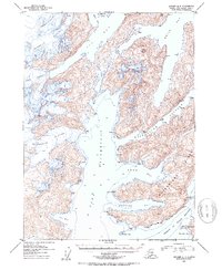
1952 Map of Seward A-4
USGS Topo · Published 1954About this map
Chenega Glacier and Tigertail Glacier dominate the northwestern reaches of this coastal Alaskan landscape, where immense ice fields descend directly into the waters of Icy Bay and Nassau Fiord. This mid-century survey reveals a highly complex coastline defined by deep glacial fjords and significant island masses, most notably Bainbridge Island and the northern tip of Evans Island. The hydrography, compiled from earlier maritime charts, shows deep-water soundings throughout Port Swanson and Whale Bay, highlighting the maritime importance of these passages before more modern tectonic shifts altered the region. Notable landmarks such as Claw Peak and Dual Head provide navigational relief against the heavily glaciated terrain, while smaller coastal features like Procession Rocks and Goat Harbor offer specific points of interest for those tracing the historical geography of the Prince William Sound area.
Find a feature on this map
24 named features on this map. Tap any name to fly to it.
Don’t see what you’re looking for? This feature index may not catch every label — zoom into the map to look around manually.
Map Details
Editions of this 1952 Seward A-4 Map
2 editions found
Other maps of this area

1946 · Blying Sound
USGS Topo · 1:250,000

1950 · Seward B-3
USGS Topo · 1:63,360

1950 · Blying Sound D-4
USGS Topo · 1:63,360

1950 · Blying Sound D-5
USGS Topo · 1:63,360

1951 · Blying Sound
USGS Topo · 1:250,000

1951 · Seward
USGS Topo · 1:250,000

1951 · Seward B-4
USGS Topo · 1:63,360

1951 · Seward A-5
USGS Topo · 1:63,360

1951 · Seward A-3
USGS Topo · 1:63,360

1951 · Seward B-5
USGS Topo · 1:63,360