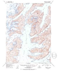
1952 Map of Seward A-4
USGS Topo · Published 1954About this map
Chenega Glacier and Tiger Glacier dominate the upper northwestern corner of this coastal Alaskan landscape, where massive ice fields meet the complex waterways of Prince William Sound. The 1952 topographic survey reveals a rugged maritime environment defined by the presence of Bainbridge Island, which is separated from the mainland by the deep channel of Bainbridge Passage. The coastline is heavily indented with numerous protective inlets like Hogg Bay, Swanson Bay, and Auk Bay, while prominent landmarks such as Claw Peak and Dual Head provide navigational points for vessels moving through Prince of Wales Passage. The map also captures several smaller glaciers, including the Tigertail Glacier and Bainbridge Glacier, illustrating the significant glaciated terrain that characterizes the Chugach National Forest region during the mid-twentieth century.
Find a feature on this map
24 named features on this map. Tap any name to fly to it.
Don’t see what you’re looking for? This feature index may not catch every label — zoom into the map to look around manually.
Map Details
Editions of this 1952 Seward A-4 Map
2 editions found

Other maps of this area

1946 · Blying Sound
USGS Topo · 1:250,000

1950 · Seward B-3
USGS Topo · 1:63,360

1950 · Blying Sound D-4
USGS Topo · 1:63,360

1950 · Blying Sound D-5
USGS Topo · 1:63,360

1951 · Blying Sound
USGS Topo · 1:250,000

1951 · Seward
USGS Topo · 1:250,000

1951 · Seward B-4
USGS Topo · 1:63,360

1951 · Seward A-5
USGS Topo · 1:63,360

1951 · Seward A-3
USGS Topo · 1:63,360

1951 · Seward B-5
USGS Topo · 1:63,360