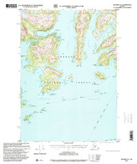
1997 Map of Seward D-2
USGS Topo · Published 2000About this map
Chugach National Forest frames this remote stretch of the Alaska coast, where the landscape is defined by deep glacial fjords like Unakwik Inlet and Wells Bay. The map captures a moment in the late twentieth century when human presence was limited to small maritime outposts and private ventures. Along the shore of Prince William Sound, the settlement of Kiniklik and various Cabin Ruins suggest the enduring but sparse history of coastal habitation. This era of mapping shows the essential role of waterborne transport, with the Alaska Marine Highway (Summer Route) cutting across the sound, connecting isolated points of interest such as the Oyster Farm (Pvt) and a designated Seaplane Anchorage. The numerous islands, including Olsen Island and Fairmount Island, serve as landmarks for navigation in a region where roads are entirely absent and the sea is the primary thoroughfare.
Find a feature on this map
34 named features on this map. Tap any name to fly to it.
Don’t see what you’re looking for? This feature index may not catch every label — zoom into the map to look around manually.
Map Details
Editions of this 1997 Seward D-2 Map
This is the sole edition of this map. No revisions or reprints were ever made.
Other maps of this area

1951 · Seward
USGS Topo · 1:250,000

1951 · Anchorage
USGS Topo · 1:250,000

1951 · Seward D-2
USGS Topo · 1:63,360

1951 · Seward D-1
USGS Topo · 1:63,360

1951 · Seward D-3
USGS Topo · 1:63,360

1951 · Seward C-1
USGS Topo · 1:63,360

1951 · Seward C-3
USGS Topo · 1:63,360

1951 · Seward C-2
USGS Topo · 1:63,360

1952 · Seward C-1
USGS Topo · 1:63,360

1952 · Seward D-1
USGS Topo · 1:63,360