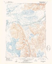
1953 Map of Cordova B-2
USGS Topo · Published 1954About this map
Ragged Mountain dominates this portion of the Chugach National Forest, separating the complex hydrological systems of the west from the drainage basins to the east. The landscape is defined by the braided channels of the Martin River and its associated water bodies, including Martin Lake and Little Martin Lake. Toward the coast, the terrain shifts into a network of tidal wetlands and waterways such as Martin Slough and Mirror Slough before meeting the Gulf of Alaska.
Find a feature on this map
15 named features on this map. Tap any name to fly to it.
Don’t see what you’re looking for? This feature index may not catch every label — zoom into the map to look around manually.
Map Details
Editions of this 1953 Cordova B-2 Map
2 editions found

Other maps of this area

1948 · Cordova
USGS Topo · 1:250,000

1950 · Cordova B-2
USGS Topo · 1:63,360

1950 · Cordova A-1
USGS Topo · 1:63,360

1950 · Cordova A-2
USGS Topo · 1:63,360

1951 · Cordova
USGS Topo · 1:250,000

1951 · Cordova B-1
USGS Topo · 1:63,360

1951 · Cordova C-3
USGS Topo · 1:63,360

1952 · Cordova B-3
USGS Topo · 1:63,360

1953 · Cordova A-2
USGS Topo · 1:63,360

1953 · Cordova B-1
USGS Topo · 1:63,360