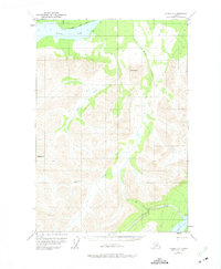
1951 Map of Valdez C-5
USGS Topo · Published 1975About this map
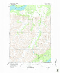
Klutina Lake dominates the northern reaches of this Alaskan interior landscape, where early 1950s aerial photography documented a transition from deep glacial waters to high alpine peaks. The terrain is defined by dramatic elevations such as Mt Simpson and Bence Mtn, which overlook a network of glacial tributaries including the Miahlo River and Manker Creek. The limited evidence of human activity is centered on a few isolated structures, including a Cabin on the northern shore and another near the southeastern edge by Tonsina Lake. A solitary Trail skirts the northern edge of the larger lake, indicating the primary route through this wilderness before more significant infrastructure reached the region. In the south, the system of smaller water bodies like Twin Lake and Greyling Creek illustrates the complex drainage patterns common to the Copper River Meridian region.
Find a feature on this map
11 named features on this map. Tap any name to fly to it.
Don’t see what you’re looking for? This feature index may not catch every label — zoom into the map to look around manually.
Map Details
Editions of this 1951 Valdez C-5 Map
3 editions found
Other maps of this area

1948 · Valdez D-5
USGS Topo · 1:63,360

1949 · Valdez D-4
USGS Topo · 1:63,360

1949 · Valdez D-6
USGS Topo · 1:63,360

1950 · Valdez C-6
USGS Topo · 1:63,360

1951 · Valdez D-5
USGS Topo · 1:63,360

1951 · Valdez D-6
USGS Topo · 1:63,360

1951 · Valdez B-5
USGS Topo · 1:63,360

1951 · Valdez C-4
USGS Topo · 1:63,360

1951 · Valdez B-4
USGS Topo · 1:63,360

1951 · Valdez C-5
USGS Topo · 1:63,360