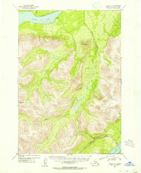
1953 Map of Valdez C-5
USGS Topo · Published 1954About this map
Klutina Lake dominates the northern edge of this high-altitude landscape in the Third Judicial Division. Surveyed in the early 1950s using aerial photography, the map reveals a wilderness shaped by massive peaks like Mt Simpson and Bence Mtn. Human presence is minimal and transient, marked only by a single Cabin on the southern shore of Klutina Lake and a narrow Trail that skirts the water's edge.
Find a feature on this map
11 named features on this map. Tap any name to fly to it.
Don’t see what you’re looking for? This feature index may not catch every label — zoom into the map to look around manually.
Map Details
Editions of this 1953 Valdez C-5 Map
2 editions found

Other maps of this area

1948 · Valdez D-5
USGS Topo · 1:63,360

1949 · Valdez D-4
USGS Topo · 1:63,360

1949 · Valdez D-6
USGS Topo · 1:63,360

1950 · Valdez C-6
USGS Topo · 1:63,360

1951 · Valdez D-5
USGS Topo · 1:63,360

1951 · Valdez D-6
USGS Topo · 1:63,360

1951 · Valdez B-5
USGS Topo · 1:63,360

1951 · Valdez C-4
USGS Topo · 1:63,360

1951 · Valdez B-4
USGS Topo · 1:63,360

1951 · Valdez C-5
USGS Topo · 1:63,360