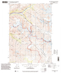
1994 Map of McCarthy B-4
USGS Topo · Published 2002About this map
Glacial valleys and industrial prospects define this remote Alaskan landscape within the Wrangell-Saint Elias National Park and National Preserve. The map documents a significant history of resource exploration, notably centering on the copper and mineral potential near Radovan Gulch and the Nelson Prospect. An Aerial Tramway and the Glacier Creek Landing Strip suggest the immense logistical challenges of 20th-century mining operations in the shadow of peaks like Mount Holmes and Andrus Peak. To the south, Rex Glacier and Rex Creek indicate the persistent ice-dominated environment. Small settlements and camps, such as Dan and various unnamed Cabin sites, dot the gulches near Copper Creek and Nikolai Gulch, marking the footprint of those who worked the land during the era of mid-century topographic compilation.
Find a feature on this map
45 named features on this map. Tap any name to fly to it.
Don’t see what you’re looking for? This feature index may not catch every label — zoom into the map to look around manually.
Map Details
Editions of this 1994 McCarthy B-4 Map
This is the sole edition of this map. No revisions or reprints were ever made.
Other maps of this area

1951 · McCarthy
USGS Topo · 1:250,000

1959 · McCarthy A-4
USGS Topo · 1:63,360

1959 · McCarthy C-5
USGS Topo · 1:63,360

1959 · McCarthy B-5
USGS Topo · 1:63,360

1959 · McCarthy C-4
USGS Topo · 1:63,360

1959 · McCarthy B-4
USGS Topo · 1:63,360

1959 · McCarthy C-3
USGS Topo · 1:63,360

1959 · McCarthy A-5
USGS Topo · 1:63,360

1959 · McCarthy A-3
USGS Topo · 1:63,360

1959 · McCarthy B-3
USGS Topo · 1:63,360