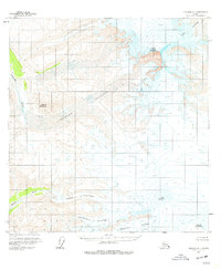
1959 Map of Gulkana A-1
USGS Topo · Published 1977About this map
Mount Sanford and the northern slopes of Mount Wrangell dominate this high-altitude landscape in the Wrangell Mountains. Derived from aerial photography taken in the late 1950s, the map reveals a massive glacial system where the Sanford Glacier and West Glacier carve through the terrain. The sheer scale of the ice is marked by numerous crevasses that line the high-elevation basins surrounding Mt Zanetti. At lower elevations, the meltwater feeds the Sanford River and Dadina River, which cut through the western edge of the quadrangle. The lack of trails or human infrastructure emphasizes the extreme wilderness of the region during this era, focusing instead on the dramatic geological features of the Chichokna Glacier, Chetaslina Glacier, and the towering presence of Nathlie Mountain.
Find a feature on this map
12 named features on this map. Tap any name to fly to it.
Don’t see what you’re looking for? This feature index may not catch every label — zoom into the map to look around manually.
Map Details
Editions of this 1959 Gulkana A-1 Map
2 editions found
Other maps of this area

1949 · Gulkana B-2
USGS Topo · 1:63,360

1950 · Nabesna
USGS Topo · 1:250,000

1951 · McCarthy
USGS Topo · 1:250,000

1951 · Gulkana
USGS Topo · 1:250,000

1951 · Nabesna
USGS Topo · 1:250,000

1952 · Valdez
USGS Topo · 1:250,000

1952 · Gulkana B-2
USGS Topo · 1:63,360

1959 · Gulkana B-1
USGS Topo · 1:63,360

1959 · Valdez D-2
USGS Topo · 1:63,360
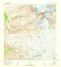
1959 · Gulkana A-1
USGS Topo · 1:63,360