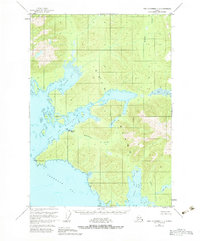
1951 Map of Port Alexander C-1
USGS Topo · Published 1983About this map
The maritime landscape of Kuiu Island is defined by a labyrinth of fjords and inlets as they appeared in the early 1950s. Industry in this corner of the Tongass National Forest is centered around the Pillar Bay Cannery and its adjacent Seaplane Base, highlighting the critical role of water-based transport in Southeast Alaska's fishing economy. The map reveals a complex shoreline where Rowan Bay and the Bay of Pillars cut deep into the timbered interior. Further south, the waters of Tebenkof Bay and Elena Bay frame a network of freshwater systems including Kutlaku Lake and Alecks Lake. Coastal landmarks like Piledriver Cove, Happy Cove, and Pt Ellis provide specific points of reference for navigating the intricate waterways between the Pacific and the interior channels of Port Camden.
Find a feature on this map
21 named features on this map. Tap any name to fly to it.
Don’t see what you’re looking for? This feature index may not catch every label — zoom into the map to look around manually.
Map Details
Editions of this 1951 Port Alexander C-1 Map
3 editions found

Other maps of this area

1948 · Port Alexander C-1
USGS Topo · 1:63,360

1948 · Petersburg B-6
USGS Topo · 1:63,360

1948 · Port Alexander B-1
USGS Topo · 1:63,360

1948 · Petersburg D-6
USGS Topo · 1:63,360

1948 · Port Alexander D-1
USGS Topo · 1:63,360

1948 · Petersburg C-6
USGS Topo · 1:63,360

1948 · Port Alexander B-2
USGS Topo · 1:63,360

1951 · Port Alexander C-2
USGS Topo · 1:63,360

1951 · Port Alexander
USGS Topo · 1:250,000

1951 · Port Alexander D-2
USGS Topo · 1:63,360