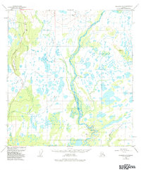
1950 Map of Gulkana C-3
USGS Topo · Published 1984About this map
Braided river channels and glacial wetlands dominate this subarctic landscape, where the Gakona River winds southward to join the Copper River. The topography is defined by low-lying marshlands interspersed with hundreds of small lakes and ponds, typical of the Copper River Basin. Rising above the damp lowlands is Hogan Hill, a prominent landmark along the western edge.
Find a feature on this map
13 named features on this map. Tap any name to fly to it.
Don’t see what you’re looking for? This feature index may not catch every label — zoom into the map to look around manually.
Map Details
Editions of this 1950 Gulkana C-3 Map
3 editions found
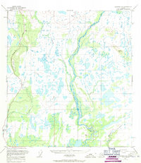
Other maps of this area

1949 · Gulkana C-2
USGS Topo · 1:63,360

1949 · Gulkana D-3
USGS Topo · 1:63,360

1949 · Gulkana B-2
USGS Topo · 1:63,360

1950 · Gulkana D-4
USGS Topo · 1:63,360

1950 · Gulkana B-3
USGS Topo · 1:63,360

1950 · Gulkana C-3
USGS Topo · 1:63,360

1950 · Gulkana C-4
USGS Topo · 1:63,360

1951 · Gulkana
USGS Topo · 1:250,000

1951 · Gulkana B-4
USGS Topo · 1:63,360

1952 · Gulkana D-3
USGS Topo · 1:63,360