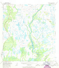
1950 Map of Gulkana C-3
USGS Topo · Published 1971About this map
The Gakona River carves a braided path through a landscape dominated by wetlands and glacial drainage patterns in this mid-century Alaskan interior survey. Flowing southward to join the Copper River, the Gakona is flanked by a dense network of small lakes and unnamed ponds. Along the western edge of the quadrangle, the Richardson Highway provides the primary corridor for movement, passing near the prominent elevation of Hogan Hill.
Find a feature on this map
9 named features on this map. Tap any name to fly to it.
Don’t see what you’re looking for? This feature index may not catch every label — zoom into the map to look around manually.
Map Details
Editions of this 1950 Gulkana C-3 Map
3 editions found
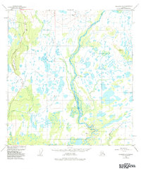
Other maps of this area

1949 · Gulkana C-2
USGS Topo · 1:63,360

1949 · Gulkana D-3
USGS Topo · 1:63,360

1949 · Gulkana B-2
USGS Topo · 1:63,360

1950 · Gulkana D-4
USGS Topo · 1:63,360

1950 · Gulkana B-3
USGS Topo · 1:63,360

1950 · Gulkana C-3
USGS Topo · 1:63,360

1950 · Gulkana C-4
USGS Topo · 1:63,360

1951 · Gulkana
USGS Topo · 1:250,000

1951 · Gulkana B-4
USGS Topo · 1:63,360

1952 · Gulkana D-3
USGS Topo · 1:63,360