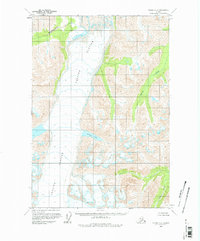
1960 Map of Valdez C-7
USGS Topo · Published 1978About this map
Tazlina Glacier dominates the central corridor of this Alaskan terrain, its massive icy reach marked by numerous Crevasses as it flows between high mountain ridges. This 1960 field annotation captures a landscape defined entirely by glacial activity and water drainage, with no roads or trails present in the area at the time of the survey. The glacier feeds into Iceberg Lake, while steep-sided valleys are carved by watercourses like Klanelneechena Creek and Kaina Creek. The southeast corner of the map shows the headwaters of the Hallet River, emphasizing the role of this frozen high country as a primary watershed. These land lines represent unsurveyed and unmarked locations as predetermined by the Bureau of Land Management, reflecting the remote nature of the Chugach Mountains region during the mid-century period.
Find a feature on this map
6 named features on this map. Tap any name to fly to it.
Don’t see what you’re looking for? This feature index may not catch every label — zoom into the map to look around manually.
Map Details
Editions of this 1960 Valdez C-7 Map
2 editions found

Other maps of this area

1949 · Valdez D-8
USGS Topo · 1:63,360

1949 · Valdez D-6
USGS Topo · 1:63,360

1949 · Valdez D-7
USGS Topo · 1:63,360

1950 · Valdez C-6
USGS Topo · 1:63,360

1951 · Valdez D-6
USGS Topo · 1:63,360

1951 · Valdez D-7
USGS Topo · 1:63,360

1951 · Valdez B-6
USGS Topo · 1:63,360

1952 · Valdez D-8
USGS Topo · 1:63,360

1952 · Valdez
USGS Topo · 1:250,000

1953 · Valdez C-6
USGS Topo · 1:63,360