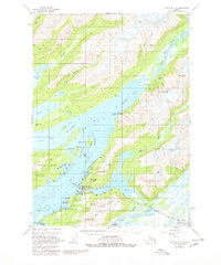
1951 Map of Cordova C-5
USGS Topo · Published 1980About this map
Cordova sits at the junction of Prince William Sound's intricate waterways, serving as a critical coastal hub during the early 1950s. The settlement is defined by its proximity to Odiak Channel and the Copper River Highway, reflecting a landscape tied to both the sea and the interior. Notable infrastructure includes the Seaplane Base on the waterfront and the Eyak Cannery situated near the mouth of Eyak Lake, signaling the importance of the local fishing industry and regional aviation. This survey highlights the complex maritime geography of The Narrows and Orca Bay, where features like Fleming Spit and Shipyard Bay suggest a history of maritime repair and transport. Inland, the Heney Range rises sharply above Eccles Lagoon, illustrating the narrow habitable corridor between the Chugach mountains and the gulf.
Find a feature on this map
64 named features on this map. Tap any name to fly to it.
Don’t see what you’re looking for? This feature index may not catch every label — zoom into the map to look around manually.
Map Details
Editions of this 1951 Cordova C-5 Map
4 editions found
Other maps of this area

1948 · Cordova
USGS Topo · 1:250,000

1950 · Cordova C-6
USGS Topo · 1:63,360

1950 · Cordova C-4
USGS Topo · 1:63,360

1950 · Cordova D-5
USGS Topo · 1:63,360

1951 · Cordova
USGS Topo · 1:250,000

1951 · Cordova B-4
USGS Topo · 1:63,360

1951 · Cordova C-5
USGS Topo · 1:63,360

1951 · Cordova B-5
USGS Topo · 1:63,360

1951 · Cordova D-6
USGS Topo · 1:63,360

1951 · Cordova D-4
USGS Topo · 1:63,360