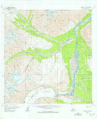
1960 Map of Nabesna A-3
USGS Topo · Published 1976About this map
Chisana and its surrounding wilderness are defined by the powerful outflow of the Chisana Glacier, which feeds the braided channels of the Chisana River. The settlement pattern recorded here shows a transition from the Chisana (Former Site) at the confluence of Cross Creek to the later location further south near Chathenda Creek. This shift, documented in the mid-20th century, highlights the movement of activity toward the modern Landing Strip and Trail networks. The landscape is dominated by significant peaks such as Mt Allen and Euchre Mountain, which overlook a complex system of glacial valleys and tributary waters like Geohenda Creek and Bow Creek. The inclusion of a Cem near the older townsite provides a vital anchor for genealogists tracing the early residents of this remote mining region.
Find a feature on this map
25 named features on this map. Tap any name to fly to it.
Don’t see what you’re looking for? This feature index may not catch every label — zoom into the map to look around manually.
Map Details
Editions of this 1960 Nabesna A-3 Map
Other maps of this area

1950 · Nabesna
USGS Topo · 1:250,000

1951 · McCarthy
USGS Topo · 1:250,000

1951 · Nabesna
USGS Topo · 1:250,000

1959 · McCarthy D-3
USGS Topo · 1:63,360

1959 · Nabesna A-4
USGS Topo · 1:63,360

1960 · Nabesna B-4
USGS Topo · 1:63,360

1960 · Nabesna A-3
USGS Topo · 1:63,360

1960 · Nabesna A-2
USGS Topo · 1:63,360

1960 · Nabesna B-2
USGS Topo · 1:63,360

1960 · Nabesna
USGS Topo · 1:250,000