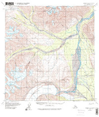
1960 Map of Nabesna A-3
USGS Topo · Published 1975About this map
The massive Chisana Glacier dominates the southern landscape of this mid-century survey, its icy expanse feeding the braided channels of the Chisana River. This region of eastern Alaska reveals a transition in settlement, most notably at the Chisana (Former Site) located along Cross Creek. By the time of this 1960 field annotation, the active community of Chisana had shifted to the southeast, near the confluence of Chathenda Creek and the river, supported by a Landing Strip and nearby Trail.
Find a feature on this map
25 named features on this map. Tap any name to fly to it.
Don’t see what you’re looking for? This feature index may not catch every label — zoom into the map to look around manually.
Map Details
Editions of this 1960 Nabesna A-3 Map
Other maps of this area

1950 · Nabesna
USGS Topo · 1:250,000

1951 · McCarthy
USGS Topo · 1:250,000

1951 · Nabesna
USGS Topo · 1:250,000

1959 · McCarthy D-3
USGS Topo · 1:63,360

1959 · Nabesna A-4
USGS Topo · 1:63,360

1960 · Nabesna B-4
USGS Topo · 1:63,360

1960 · Nabesna A-3
USGS Topo · 1:63,360

1960 · Nabesna A-2
USGS Topo · 1:63,360

1960 · Nabesna B-2
USGS Topo · 1:63,360

1960 · Nabesna
USGS Topo · 1:250,000