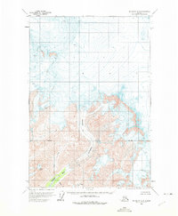
1960 Map of McCarthy D-8
USGS Topo · Published 1975About this map
The vast ice field of the Kluvesna Glacier dominates the northern half of this 1960 survey, a landscape defined by deep crevasses and high alpine terrain. Flowing south from the glacial terminus, the Kluvesna River carves through the mountains, joined by tributaries including Fall Creek, Mineral Creek, and Surprise Creek. These watercourses mark the drainage patterns of a wilderness area mapped using photogrammetric methods from late 1950s aerial photography.
Find a feature on this map
8 named features on this map. Tap any name to fly to it.
Don’t see what you’re looking for? This feature index may not catch every label — zoom into the map to look around manually.
Map Details
Editions of this 1960 McCarthy D-8 Map
2 editions found

Other maps of this area

1950 · Nabesna
USGS Topo · 1:250,000

1951 · McCarthy
USGS Topo · 1:250,000

1951 · Gulkana
USGS Topo · 1:250,000

1951 · Nabesna
USGS Topo · 1:250,000

1951 · McCarthy C-8
USGS Topo · 1:63,360

1951 · Valdez C-1
USGS Topo · 1:63,360

1952 · Valdez
USGS Topo · 1:250,000

1953 · Valdez C-1
USGS Topo · 1:63,360
1959 · Gulkana A-1
USGS Topo · 1:63,360

1959 · Gulkana
USGS Topo · 1:250,000