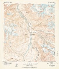
1952 Map of Mt. Hayes B-4
USGS Topo · Published 1952About this map
The Millers Roadhouse (Abandoned) serves as a quiet marker of early travel along the Richardson Highway in the mid-twentieth century. This corridor follows the Delta River through the Alaska Range, a landscape dominated by the massive ice flows of the Black Rapids Glacier, Castner Glacier, and Canwell Glacier. The map captures a transition in high-altitude surveying, utilizing triangulation stations like VABM Miller and VABM Castner to map the drainage patterns of Phelan Creek and the many forks of Rainy Creek. The presence of mile markers such as Mile 210 and Mile 220 emphasizes the highway's role as a vital interior artery during a period when much of the surrounding terrain, including Rainbow Mtn, remained largely untouched by permanent settlement.
Find a feature on this map
27 named features on this map. Tap any name to fly to it.
Don’t see what you’re looking for? This feature index may not catch every label — zoom into the map to look around manually.
Map Details
Editions of this 1952 Mt. Hayes B-4 Map
2 editions found

Other maps of this area

1949 · Mount Hayes A-4
USGS Topo · 1:63,360

1949 · Mount Hayes A-5
USGS Topo · 1:63,360

1950 · Mount Hayes
USGS Topo · 1:250,000

1950 · Mount Hayes C-4
USGS Topo · 1:63,360

1950 · Mount Hayes A-3
USGS Topo · 1:63,360

1951 · Mount Hayes
USGS Topo · 1:250,000

1951 · Mount Hayes C-5
USGS Topo · 1:63,360

1951 · Mt. Hayes B-5
USGS Topo · 1:63,360

1952 · Mount Hayes A-3
USGS Topo · 1:63,360

1952 · Mount Hayes A-4
USGS Topo · 1:63,360