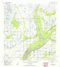
1949 Map of Gulkana C-2
USGS Topo · Published 1969About this map
Chistochina River and the Copper River dominate this 1949 landscape at their confluence, reflecting the hydraulic character of the Copper River Basin. The settlement of Chistochina appears along the northern bank of the Copper River, positioned where the Glenn Highway traverses the region. This road network was critical for interior travel during the mid-century, and the map records localized infrastructure such as a Landing Strip and a Grave Pit near the village.
Find a feature on this map
13 named features on this map. Tap any name to fly to it.
Don’t see what you’re looking for? This feature index may not catch every label — zoom into the map to look around manually.
Map Details
Editions of this 1949 Gulkana C-2 Map
2 editions found
Other maps of this area

1949 · Gulkana C-2
USGS Topo · 1:63,360

1949 · Gulkana D-3
USGS Topo · 1:63,360

1949 · Gulkana B-2
USGS Topo · 1:63,360

1949 · Gulkana C-1
USGS Topo · 1:63,360

1950 · Gulkana B-3
USGS Topo · 1:63,360

1950 · Gulkana C-3
USGS Topo · 1:63,360

1951 · Gulkana
USGS Topo · 1:250,000

1952 · Gulkana D-3
USGS Topo · 1:63,360

1952 · Gulkana B-3
USGS Topo · 1:63,360

1952 · Gulkana B-2
USGS Topo · 1:63,360