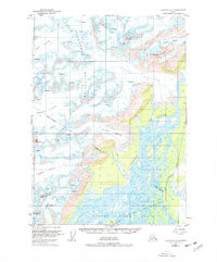
1951 Map of Cordova C-3
USGS Topo · Published 1978About this map
Childs Glacier and the massive flow of the Copper River dominate this 1951 topographic study of the Chugach Mountains region. The map captures a landscape defined by moving ice and shifting water, where the Copper River Delta spreads across the southern portion of the sheet. The presence of the Copper River Highway tracking the riverbank provides a lone sign of human infrastructure through this terrain.
Find a feature on this map
21 named features on this map. Tap any name to fly to it.
Don’t see what you’re looking for? This feature index may not catch every label — zoom into the map to look around manually.
Map Details
Editions of this 1951 Cordova C-3 Map
2 editions found
Other maps of this area

1948 · Cordova
USGS Topo · 1:250,000

1950 · Cordova B-2
USGS Topo · 1:63,360

1950 · Cordova C-4
USGS Topo · 1:63,360

1950 · Cordova D-3
USGS Topo · 1:63,360

1951 · Cordova
USGS Topo · 1:250,000

1951 · Cordova B-4
USGS Topo · 1:63,360

1951 · Cordova C-3
USGS Topo · 1:63,360

1951 · Cordova D-4
USGS Topo · 1:63,360

1952 · Cordova B-3
USGS Topo · 1:63,360

1953 · Cordova D-4
USGS Topo · 1:63,360