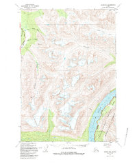
1951 Map of Valdez B-3
USGS Topo · Published 1993About this map
The settlement of Ernestine stands as a focal point in this 1951 study of the Alaskan interior, situated along the vital Richardson Highway. This corridor represents a critical overland link in the mid-century, following the drainages of the Little Tonsina River and Tiekel River. The terrain is defined by a dense network of glacial and mountain streams, including Mosquito Creek and Ernestine Creek, which carve through the high elevations between the highway and the massive Copper River valley to the east.
Find a feature on this map
16 named features on this map. Tap any name to fly to it.
Don’t see what you’re looking for? This feature index may not catch every label — zoom into the map to look around manually.
Map Details
Editions of this 1951 Valdez B-3 Map
3 editions found
Other maps of this area

1950 · Valdez A-3
USGS Topo · 1:63,360

1951 · Valdez B-2
USGS Topo · 1:63,360

1951 · Valdez B-3
USGS Topo · 1:63,360

1951 · Valdez C-2
USGS Topo · 1:63,360

1951 · Valdez C-3
USGS Topo · 1:63,360

1951 · Valdez C-4
USGS Topo · 1:63,360

1951 · Valdez B-4
USGS Topo · 1:63,360

1951 · Valdez A-2
USGS Topo · 1:63,360

1952 · Valdez
USGS Topo · 1:250,000

1953 · Valdez C-2
USGS Topo · 1:63,360