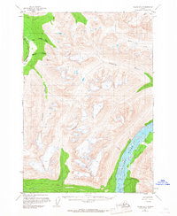
1951 Map of Valdez B-3
USGS Topo · Published 1967About this map
The braided channels of the Copper River dominate the southeastern corner of this Alaskan interior landscape, where glacial runoff and high-altitude drainage systems carve through the terrain. To the northwest, the Richardson Highway serves as the primary corridor for movement, passing through Tiekel and running parallel to the Little Tonsina River. This 1950s survey shows a landscape defined by water and elevation, from the isolated Cabin near the highway to the high survey point at VABM 5014 Ernestine. Major tributaries like the Uranatina River and Tonsina River slice through the central peaks, while numerous unnamed glacial lakes dot the high-country basins. The presence of the highway next to the Ernestine Creek drainage highlights the reliance on specific river valleys for transportation through the Chugach and Wrangell transition zones.
Find a feature on this map
15 named features on this map. Tap any name to fly to it.
Don’t see what you’re looking for? This feature index may not catch every label — zoom into the map to look around manually.
Map Details
Editions of this 1951 Valdez B-3 Map
3 editions found
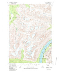
Other maps of this area

1950 · Valdez A-3
USGS Topo · 1:63,360

1951 · Valdez B-2
USGS Topo · 1:63,360

1951 · Valdez B-3
USGS Topo · 1:63,360

1951 · Valdez C-2
USGS Topo · 1:63,360

1951 · Valdez C-3
USGS Topo · 1:63,360

1951 · Valdez C-4
USGS Topo · 1:63,360

1951 · Valdez B-4
USGS Topo · 1:63,360

1951 · Valdez A-2
USGS Topo · 1:63,360

1952 · Valdez
USGS Topo · 1:250,000

1953 · Valdez C-2
USGS Topo · 1:63,360