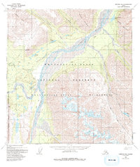
1960 Map of Nabesna B-4
USGS Topo · Published 1994About this map
The Nabesna River carves a wide glacial path through this Alaskan interior landscape, separating the Mentasta Mountains to the north from the massive elevations of the Wrangell - St Elias National Preserve to the south. This era of mapping shows a high-altitude wilderness defined by its seasonal transport routes, where a Winter Trail follows the riverbank and an isolated Landing Strip provides the primary connection to the Devils Mountain Lodge. Scattered evidence of human activity is found in a lone Cabin near Jack Creek and the designated Wilderness Boundary that bisects the southern peaks. Localized hydrology is represented by numerous high-country water bodies, including Whitham Lake, Virginia Lake, and Punk Lake, which feed the various tributaries flowing toward the primary river valley.
Find a feature on this map
33 named features on this map. Tap any name to fly to it.
Don’t see what you’re looking for? This feature index may not catch every label — zoom into the map to look around manually.
Map Details
Editions of this 1960 Nabesna B-4 Map
3 editions found
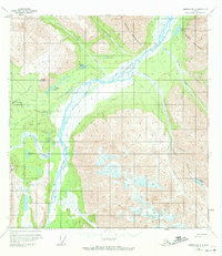
Other maps of this area

1950 · Nabesna
USGS Topo · 1:250,000

1951 · Nabesna
USGS Topo · 1:250,000

1954 · Nabesna C-3
USGS Topo · 1:63,360

1955 · Nabesna C-3
USGS Topo · 1:63,360

1957 · Nabesna C-5
USGS Topo · 1:63,360

1959 · Nabesna A-4
USGS Topo · 1:63,360

1959 · Nabesna A-5
USGS Topo · 1:63,360

1960 · Nabesna B-4
USGS Topo · 1:63,360

1960 · Nabesna B-5
USGS Topo · 1:63,360

1960 · Nabesna A-3
USGS Topo · 1:63,360