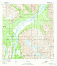
1960 Map of Nabesna B-4
USGS Topo · Published 1972About this map
The Nabesna River corridor dominates this interior Alaskan landscape, serving as a braided waterway through the valley between the Mentasta Mountains and the Nutzotin Mountains. In this mid-century period, human presence is concentrated near the river’s western banks at Devils Mountain Lodge, supported by essential bush aviation infrastructure including Reeve Field and a nearby Landing Strip. The network of Tractor Trails suggests the rugged nature of transport across the tundra and through the Raven Hills Creek drainage. To the south, high-elevation topography like Devils Mountain and Gold Hill loom over a series of remote water bodies, including Fish Creek Lake, Virginia Lake, and Whitham Lake. The map reveals a land defined by seasonal drainages like Platinum Creek and Totschunda Creek, where glacial runoff from the surrounding peaks feeds the wide, shifting gravel bars of the main river valley.
Find a feature on this map
29 named features on this map. Tap any name to fly to it.
Don’t see what you’re looking for? This feature index may not catch every label — zoom into the map to look around manually.
Map Details
Editions of this 1960 Nabesna B-4 Map
3 editions found
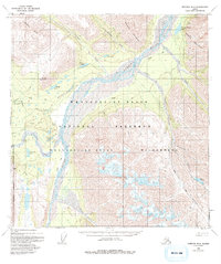
Other maps of this area

1950 · Nabesna
USGS Topo · 1:250,000

1951 · Nabesna
USGS Topo · 1:250,000

1954 · Nabesna C-3
USGS Topo · 1:63,360

1955 · Nabesna C-3
USGS Topo · 1:63,360

1957 · Nabesna C-5
USGS Topo · 1:63,360

1959 · Nabesna A-4
USGS Topo · 1:63,360

1959 · Nabesna A-5
USGS Topo · 1:63,360

1960 · Nabesna B-4
USGS Topo · 1:63,360

1960 · Nabesna B-5
USGS Topo · 1:63,360

1960 · Nabesna A-3
USGS Topo · 1:63,360