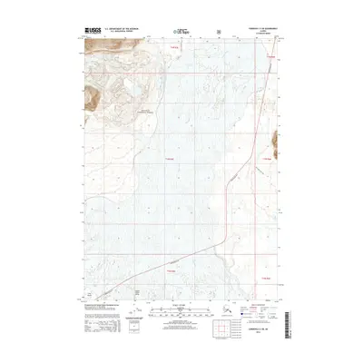
2014 Map of Cordova C-3 SE
USGS Topo · Published 2014About this map
Copper River Delta dominates this coastal Alaska survey, showcasing a complex hydrologic landscape where the braided Copper River meets the Gulf. The vast drainage system is set against the protected lands of the Chugach National Forest, illustrating the intersection of maritime influence and glacial runoff. Transportation through this remote terrain is anchored by the Copper River Hwy, which provides the primary access route across the delta. The map records several notable landmarks and routes, including the Goat Mountain Trail and the Childs Glacier S Trail, indicating a focus on access and forest management. Features like Long Island and Sheep Cr provide specific geographic markers within the larger expanse of river channels and tidal flats, reflecting the area's significance for both natural resource monitoring and regional connectivity.
Find a feature on this map
14 named features on this map. Tap any name to fly to it.
Don’t see what you’re looking for? This feature index may not catch every label — zoom into the map to look around manually.
Map Details
Editions of this 2014 Cordova C-3 SE Map
This is the sole edition of this map. No revisions or reprints were ever made.
Other maps of this area

1948 · Cordova
USGS Topo · 1:250,000

1950 · Cordova B-2
USGS Topo · 1:63,360

1951 · Cordova
USGS Topo · 1:250,000

1951 · Cordova C-3
USGS Topo · 1:63,360

1952 · Cordova B-3
USGS Topo · 1:63,360

1953 · Cordova C-3
USGS Topo · 1:63,360

1953 · Cordova B-2
USGS Topo · 1:63,360

1953 · Cordova B-3
USGS Topo · 1:63,360

1959 · Cordova C-2
USGS Topo · 1:63,360

1959 · Cordova
USGS Topo · 1:250,000