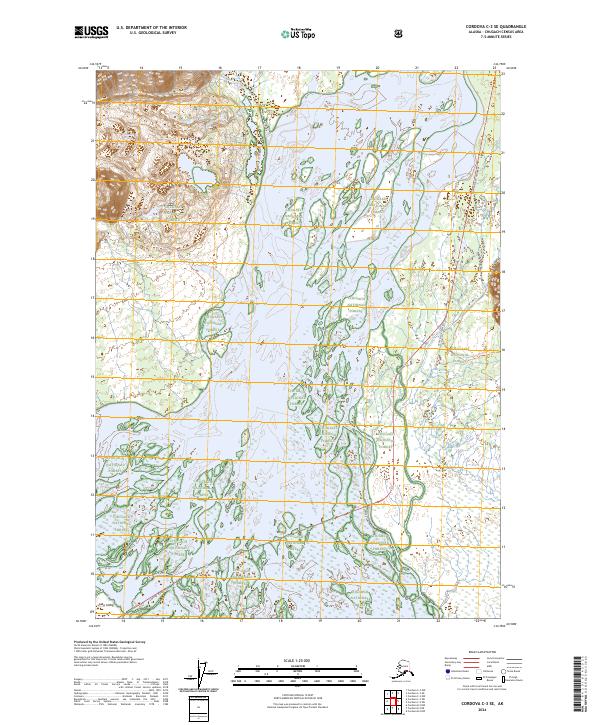
2024 Map of Cordova C-3 SE
USGS Topo · Published 2024About this map
The Copper River dominates this landscape, its braided channels and vast wetlands winding through the Chugach National Forest. On the western edge, the massive Goodwin Glacier spills down from the high peaks toward the river valley, illustrating the powerful glacial forces that continue to shape this region. The presence of Long Island within the river's path highlights the shifting nature of the silt-laden waters and the complex delta system that defines the local geography.
Find a feature on this map
14 named features on this map. Tap any name to fly to it.
Don’t see what you’re looking for? This feature index may not catch every label — zoom into the map to look around manually.
Map Details
Editions of this 2024 Cordova C-3 SE Map
This is the sole edition of this map. No revisions or reprints were ever made.
Other maps of this area

1948 · Cordova
USGS Topo · 1:250,000

1950 · Cordova B-2
USGS Topo · 1:63,360

1951 · Cordova
USGS Topo · 1:250,000

1951 · Cordova C-3
USGS Topo · 1:63,360

1952 · Cordova B-3
USGS Topo · 1:63,360

1953 · Cordova C-3
USGS Topo · 1:63,360

1953 · Cordova B-2
USGS Topo · 1:63,360

1953 · Cordova B-3
USGS Topo · 1:63,360

1959 · Cordova C-2
USGS Topo · 1:63,360

1959 · Cordova
USGS Topo · 1:250,000