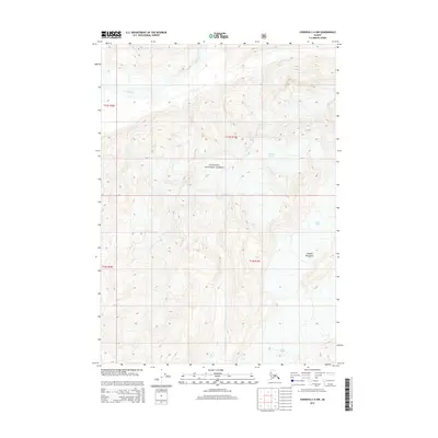
2014 Map of Cordova C-4 NW
USGS Topo · Published 2014About this map
Chugach National Forest dominates this Alaskan landscape, where the high peaks of the Chugach Mountains dictate the flow of ice and water. Massive ice fields define the eastern portion of the map, specifically the Scott Glacier and Shephard Glacier, which serve as significant markers of the glacial environment. This terrain is a study in natural drainage patterns, as the Rude River winds through the northern valleys while Power Cr drains the southwestern slopes. The absence of permanent settlements or roads highlights the isolation of this region within the Chugach Mountains, where the landscape is shaped entirely by topographic relief and the slow movement of alpine glaciers.
Find a feature on this map
10 named features on this map. Tap any name to fly to it.
Don’t see what you’re looking for? This feature index may not catch every label — zoom into the map to look around manually.
Map Details
Editions of this 2014 Cordova C-4 NW Map
This is the sole edition of this map. No revisions or reprints were ever made.
Other maps of this area

1948 · Cordova
USGS Topo · 1:250,000

1950 · Cordova C-4
USGS Topo · 1:63,360

1950 · Cordova D-5
USGS Topo · 1:63,360

1951 · Cordova
USGS Topo · 1:250,000

1951 · Cordova C-5
USGS Topo · 1:63,360

1951 · Cordova D-4
USGS Topo · 1:63,360

1953 · Cordova D-5
USGS Topo · 1:63,360

1953 · Cordova D-4
USGS Topo · 1:63,360

1953 · Cordova C-4
USGS Topo · 1:63,360

1953 · Cordova C-5
USGS Topo · 1:63,360