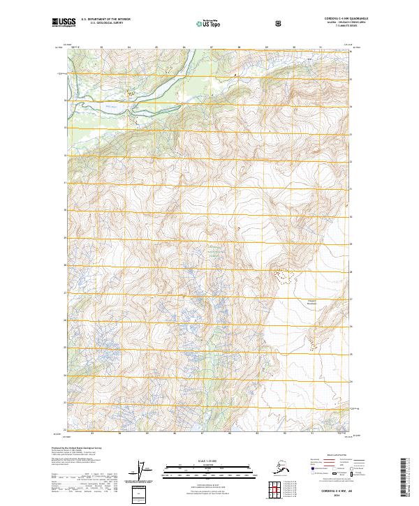
2024 Map of Cordova C-4 NW
USGS Topo · Published 2024About this map
Chugach National Forest encompasses the entirety of this Alaskan wilderness landscape, where the high-altitude terrain of the Chugach Mountains meets a complex network of glacial drainage. The northern portion of the sheet is dominated by the broad valley of the Rude River, while the southern reaches transition into a low-lying riparian system characterized by Government Slough. A single human-made path, the Sand Trl, appears in the southern sections, suggesting limited seasonal access to these remote reaches. The survey detail captures the intricate braided patterns of the waterways as they move through the mountainous terrain, providing a look at the natural landscape as it remained in the early 21st century before modern developments or shifts in the water table could alter these drainage paths.
Find a feature on this map
9 named features on this map. Tap any name to fly to it.
Don’t see what you’re looking for? This feature index may not catch every label — zoom into the map to look around manually.
Map Details
Editions of this 2024 Cordova C-4 NW Map
This is the sole edition of this map. No revisions or reprints were ever made.
Other maps of this area

1948 · Cordova
USGS Topo · 1:250,000

1950 · Cordova C-4
USGS Topo · 1:63,360

1950 · Cordova D-5
USGS Topo · 1:63,360

1951 · Cordova
USGS Topo · 1:250,000

1951 · Cordova C-5
USGS Topo · 1:63,360

1951 · Cordova D-4
USGS Topo · 1:63,360

1953 · Cordova D-5
USGS Topo · 1:63,360

1953 · Cordova D-4
USGS Topo · 1:63,360

1953 · Cordova C-4
USGS Topo · 1:63,360

1953 · Cordova C-5
USGS Topo · 1:63,360