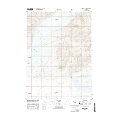
2014 Map of Cordova C-4 SW
USGS Topo · Published 2014About this map
Chugach National Forest encompasses this glacial landscape, where the shifting hydrology of the Glacier River and Sheridan River dominates the lowlands. The area is defined by its dramatic transition from the massive Scott Glacier in the north to a dense network of freshwater bodies, including Lake Elsner, Siamese Lakes, and Eleanor Lake. Several established routes provide access through the variable terrain, such as the Sand Trail and the Lake Elsner Trail. The drainage patterns of Government Slough and Ibeck Cr illustrate the complex water systems fed by glacial melt, while the Sheridan Mountain Trail offers a route toward higher elevations overlooking the river valleys. This survey captures the topographical state of the Copper River Delta region during the early 21st century.
Find a feature on this map
27 named features on this map. Tap any name to fly to it.
Don’t see what you’re looking for? This feature index may not catch every label — zoom into the map to look around manually.
Map Details
Editions of this 2014 Cordova C-4 SW Map
This is the sole edition of this map. No revisions or reprints were ever made.
Other maps of this area

1948 · Cordova
USGS Topo · 1:250,000

1950 · Cordova C-4
USGS Topo · 1:63,360

1951 · Cordova
USGS Topo · 1:250,000

1951 · Cordova B-4
USGS Topo · 1:63,360

1951 · Cordova C-5
USGS Topo · 1:63,360

1951 · Cordova B-5
USGS Topo · 1:63,360

1953 · Cordova B-5
USGS Topo · 1:63,360

1953 · Cordova C-4
USGS Topo · 1:63,360

1953 · Cordova C-5
USGS Topo · 1:63,360

1959 · Cordova
USGS Topo · 1:250,000