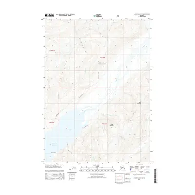
2014 Map of Cordova C-5 NE
USGS Topo · Published 2014About this map
Chugach National Forest encompasses this wilderness region near Cordova, where the glacial and river systems of the Alaskan coast meet the Gulf of Alaska. The landscape is defined by the significant drainage of the Rude River, which flows south into the sheltered waters of Nelson Bay. Historically important access is maintained through a network of terrestrial routes including the Rude River N Trail and Rude River S Trail, providing passage through the steep terrain between Kelly Mountain and Snyder Mountain. At the bay's edge, Shepard Point stands as a prominent coastal landmark, connected to the interior via the Shepard Point Trail. Numerous seasonal and permanent waterways like Wesley Falls Cr and Parson Falls Cr demonstrate the area's intricate hydrological profile, while Power Cr drains the southeastern heights of this coastal environment.
Find a feature on this map
21 named features on this map. Tap any name to fly to it.
Don’t see what you’re looking for? This feature index may not catch every label — zoom into the map to look around manually.
Map Details
Editions of this 2014 Cordova C-5 NE Map
This is the sole edition of this map. No revisions or reprints were ever made.
Other maps of this area

1948 · Cordova
USGS Topo · 1:250,000

1950 · Cordova C-4
USGS Topo · 1:63,360

1950 · Cordova D-5
USGS Topo · 1:63,360

1951 · Cordova
USGS Topo · 1:250,000

1951 · Cordova C-5
USGS Topo · 1:63,360

1951 · Cordova D-4
USGS Topo · 1:63,360

1953 · Cordova D-5
USGS Topo · 1:63,360

1953 · Cordova D-4
USGS Topo · 1:63,360

1953 · Cordova C-4
USGS Topo · 1:63,360

1953 · Cordova C-5
USGS Topo · 1:63,360