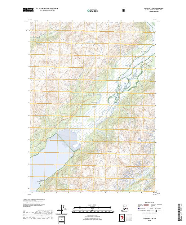
2024 Map of Cordova C-5 NE
USGS Topo · Published 2024About this map
Cordova sits at the southwestern edge of this coastal landscape, where the town meets the waters of Nelson Bay. The terrain is defined by the steep slopes of Kelly Mtn and Snyder Mtn, rising sharply from the glacial valleys of the Rude River. This area, located within the Chugach National Forest, shows a complex network of drainage systems including Parson Falls Creek, Wesley Falls Creek, and Snyder Falls Creek. The map documents a rugged coastal interface where the maritime environment of Shepard Point transitions into high-altitude ridges. Notable for those tracking land use and access, the sheet highlights several established routes such as the Rude River North Trl and the Shepard Point Trl, which provide the primary means of navigating these steep grades and river corridors.
Find a feature on this map
20 named features on this map. Tap any name to fly to it.
Don’t see what you’re looking for? This feature index may not catch every label — zoom into the map to look around manually.
Map Details
Editions of this 2024 Cordova C-5 NE Map
This is the sole edition of this map. No revisions or reprints were ever made.
Other maps of this area

1948 · Cordova
USGS Topo · 1:250,000

1950 · Cordova C-4
USGS Topo · 1:63,360

1950 · Cordova D-5
USGS Topo · 1:63,360

1951 · Cordova
USGS Topo · 1:250,000

1951 · Cordova C-5
USGS Topo · 1:63,360

1951 · Cordova D-4
USGS Topo · 1:63,360

1953 · Cordova D-5
USGS Topo · 1:63,360

1953 · Cordova D-4
USGS Topo · 1:63,360

1953 · Cordova C-4
USGS Topo · 1:63,360

1953 · Cordova C-5
USGS Topo · 1:63,360