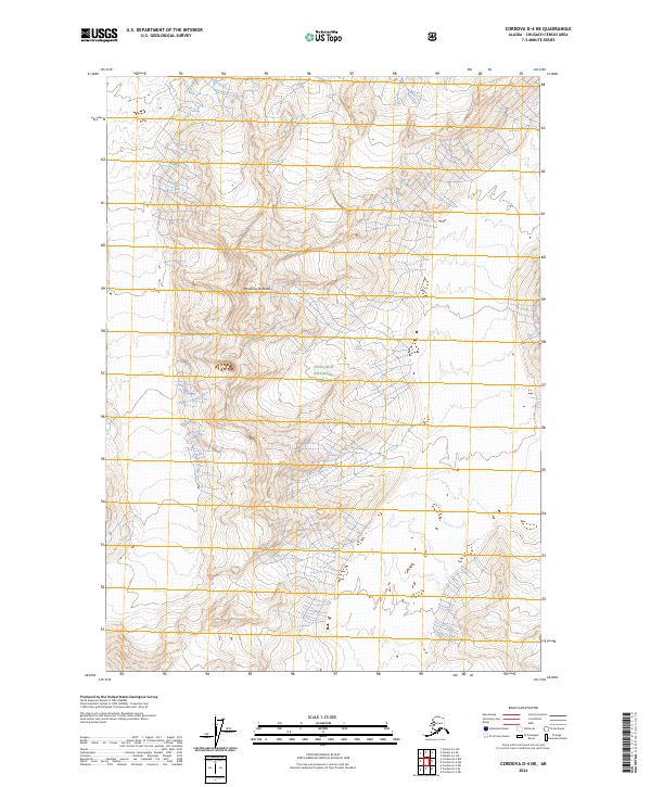
2024 Map of Cordova D-4 NE
USGS Topo · Published 2024About this map
Mt Jimmy Doolittle stands as a prominent topographical landmark within this high-elevation Alaskan landscape, located in the heart of the Chugach National Forest. The 2024 survey documents the complex contours and drainage patterns of the Chugach Census Area, where glacial-carved terrain meets the boundaries of t10s r1e, t11s r1e, and t10s r2e. Unlike many coastal Alaskan maps, this sheet focuses on the high-country interior, offering a clear record of natural features and land management lines in a region defined by its isolation and lack of permanent settlements. The land remains under the jurisdiction of the Chugach National Forest, with the map serving as a critical reference for understanding the modern footprint of these protected federal lands.
Find a feature on this map
6 named features on this map. Tap any name to fly to it.
Don’t see what you’re looking for? This feature index may not catch every label — zoom into the map to look around manually.
Map Details
Editions of this 2024 Cordova D-4 NE Map
This is the sole edition of this map. No revisions or reprints were ever made.
Other maps of this area

1948 · Cordova
USGS Topo · 1:250,000

1950 · Valdez A-3
USGS Topo · 1:63,360

1950 · Cordova D-3
USGS Topo · 1:63,360

1951 · Cordova
USGS Topo · 1:250,000

1951 · Cordova D-4
USGS Topo · 1:63,360

1952 · Valdez
USGS Topo · 1:250,000

1953 · Cordova D-4
USGS Topo · 1:63,360

1953 · Cordova D-3
USGS Topo · 1:63,360

1953 · Valdez A-4
USGS Topo · 1:63,360

1953 · Valdez A-3
USGS Topo · 1:63,360