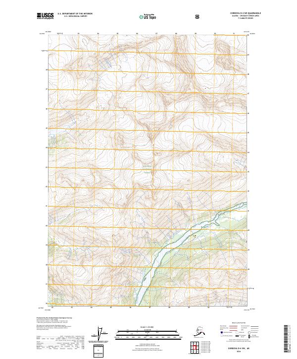
2024 Map of Cordova D-4 SW
USGS Topo · Published 2024About this map
Rude River carves a deep valley through the high-elevation landscape of the Chugach National Forest in this coastal Alaskan region. The terrain is defined by extreme relief and glacial drainage patterns, where the river flows southwest toward the coast. This map illustrates the intersection of several township and range boundaries, including t12s r1w and t12s r2w, which establish the public land survey system grid across this unpopulated wilderness. The concentration of contours along the river corridor reveals the steep slopes that characterize the southern Chugach Mountains, offering a clear view of the natural hydrology and drainage basins that feed into the Prince William Sound area.
Find a feature on this map
8 named features on this map. Tap any name to fly to it.
Don’t see what you’re looking for? This feature index may not catch every label — zoom into the map to look around manually.
Map Details
Editions of this 2024 Cordova D-4 SW Map
This is the sole edition of this map. No revisions or reprints were ever made.
Other maps of this area

1948 · Cordova
USGS Topo · 1:250,000

1950 · Cordova C-4
USGS Topo · 1:63,360

1950 · Cordova D-5
USGS Topo · 1:63,360

1951 · Cordova
USGS Topo · 1:250,000

1951 · Cordova C-5
USGS Topo · 1:63,360

1951 · Cordova D-4
USGS Topo · 1:63,360

1953 · Cordova D-5
USGS Topo · 1:63,360

1953 · Cordova D-4
USGS Topo · 1:63,360

1953 · Cordova C-4
USGS Topo · 1:63,360

1953 · Cordova C-5
USGS Topo · 1:63,360