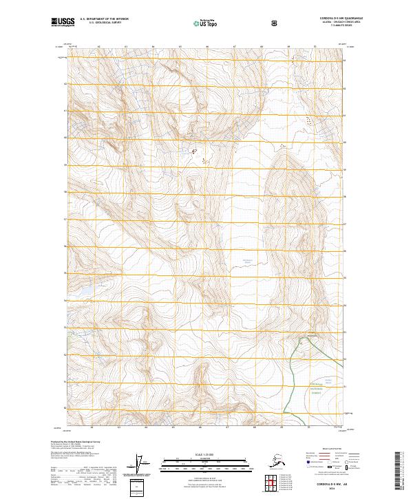
2024 Map of Cordova D-5 NW
USGS Topo · Published 2024About this map
Chugach Mountains dominate the high-altitude topography of this landscape, where glaciation continues to carve the remote terrain. The eastern portion of the map is defined by the Chugach National Forest boundary, a region where moving ice meets the forest edge. Notable ice masses like Wortmanns Glacier and the Cordova Glacier are primary features, illustrating the active glacial environment of this part of Alaska. Beneath the peaks, drainages such as Dead Creek flow through the valleys, marking the natural runoff patterns from the surrounding ice and snow. The map provides a clear look at the relationship between high mountain ridges and the glacial flows that shape the local hydrology, with no human settlements or road networks indicated in this high-wilderness area.
Find a feature on this map
9 named features on this map. Tap any name to fly to it.
Don’t see what you’re looking for? This feature index may not catch every label — zoom into the map to look around manually.
Map Details
Editions of this 2024 Cordova D-5 NW Map
This is the sole edition of this map. No revisions or reprints were ever made.
Other maps of this area

1948 · Cordova
USGS Topo · 1:250,000

1950 · Cordova D-5
USGS Topo · 1:63,360

1951 · Cordova
USGS Topo · 1:250,000

1951 · Cordova D-6
USGS Topo · 1:63,360

1951 · Valdez A-6
USGS Topo · 1:63,360

1952 · Valdez
USGS Topo · 1:250,000

1952 · Valdez A-6
USGS Topo · 1:63,360

1953 · Cordova D-5
USGS Topo · 1:63,360

1953 · Cordova D-6
USGS Topo · 1:63,360

1953 · Valdez A-5
USGS Topo · 1:63,360