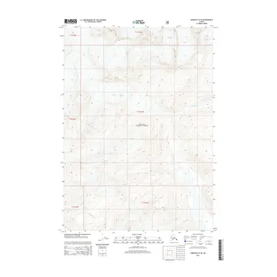
2014 Map of Cordova D-5 SE
USGS Topo · Published 2014About this map
Chugach National Forest dominates this Alaskan landscape, where the movement of ice has carved deep valleys and high ridgelines within the unorganized borough. The northern reaches are defined by the massive Cordova Glacier and Woodworth Glacier, while the southern terrain transitions toward Rude Lake. This 2014 survey captures a moment in a dynamic glacial environment, documenting the extent of ice flows and high-altitude topography across several townships, including t12s r2w and t13s r2w. The lack of man-made structures or roads emphasizes the isolation of this wilderness area, making the map an essential reference for understanding the physical geography and glacial boundaries of the Prince William Sound region.
Find a feature on this map
10 named features on this map. Tap any name to fly to it.
Don’t see what you’re looking for? This feature index may not catch every label — zoom into the map to look around manually.
Map Details
Editions of this 2014 Cordova D-5 SE Map
This is the sole edition of this map. No revisions or reprints were ever made.
Other maps of this area

1948 · Cordova
USGS Topo · 1:250,000

1950 · Cordova C-4
USGS Topo · 1:63,360

1950 · Cordova D-5
USGS Topo · 1:63,360

1951 · Cordova
USGS Topo · 1:250,000

1951 · Cordova C-5
USGS Topo · 1:63,360

1951 · Cordova D-4
USGS Topo · 1:63,360

1953 · Cordova D-5
USGS Topo · 1:63,360

1953 · Cordova D-4
USGS Topo · 1:63,360

1953 · Cordova C-4
USGS Topo · 1:63,360

1953 · Cordova C-5
USGS Topo · 1:63,360