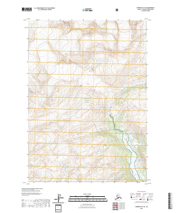
2024 Map of Cordova D-5 SE
USGS Topo · Published 2024About this map
The glacial landscapes and high-altitude terrain of the Chugach National Forest dominate this contemporary survey. At the heart of the quadrangle lies the Cordova Glacier, a massive ice body that shapes the local hydrology and topography. This 2024 data reflects the current state of a region largely defined by its natural features rather than human infrastructure, with no permanent settlements, roads, or buildings indicated on the sheet. Instead, the map provides a precise look at the township and range boundaries, including t12s r2w and t12s r3w, which help orient researchers and land managers in this remote portion of Alaska. The focus is entirely on the physical geography, from the ice fields to the intricate contour lines that detail the steep elevation changes surrounding the glacier.
Find a feature on this map
8 named features on this map. Tap any name to fly to it.
Don’t see what you’re looking for? This feature index may not catch every label — zoom into the map to look around manually.
Map Details
Editions of this 2024 Cordova D-5 SE Map
This is the sole edition of this map. No revisions or reprints were ever made.
Other maps of this area

1948 · Cordova
USGS Topo · 1:250,000

1950 · Cordova C-4
USGS Topo · 1:63,360

1950 · Cordova D-5
USGS Topo · 1:63,360

1951 · Cordova
USGS Topo · 1:250,000

1951 · Cordova C-5
USGS Topo · 1:63,360

1951 · Cordova D-4
USGS Topo · 1:63,360

1953 · Cordova D-5
USGS Topo · 1:63,360

1953 · Cordova D-4
USGS Topo · 1:63,360

1953 · Cordova C-4
USGS Topo · 1:63,360

1953 · Cordova C-5
USGS Topo · 1:63,360