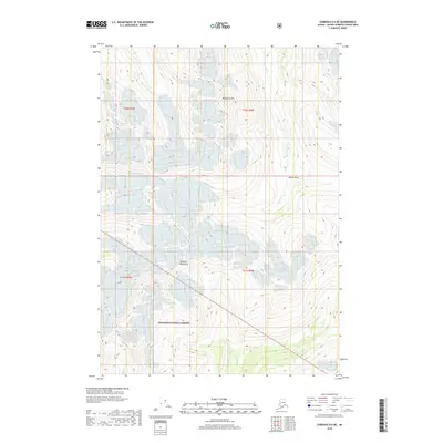
2018 Map of Cordova D-6 NE
USGS Topo · Published 2018About this map
Meteorite Mtn dominates the northern skyline of this Alaskan high-country landscape, rising above the extensive glacial valleys and alpine basins within the Chugach National Forest. The map documents a wilderness primarily shaped by natural forces, where Brown Basin sits at the headwaters of the drainage network. This area is defined by the high peaks of the Chugach Mountains, which feed several watercourses including Browns Creek and the southern-flowing Dead Cr. The absence of roads or permanent settlements underscores the isolation of this terrain in the Unorganized Borough, where only the township and range lines of t10s r4w and t11s r5w provide a human-imposed grid over the ice-carved topography.
Find a feature on this map
11 named features on this map. Tap any name to fly to it.
Don’t see what you’re looking for? This feature index may not catch every label — zoom into the map to look around manually.
Map Details
Editions of this 2018 Cordova D-6 NE Map
This is the sole edition of this map. No revisions or reprints were ever made.
Other maps of this area

1948 · Cordova
USGS Topo · 1:250,000

1950 · Cordova D-5
USGS Topo · 1:63,360

1951 · Cordova
USGS Topo · 1:250,000

1951 · Cordova D-6
USGS Topo · 1:63,360

1951 · Valdez A-6
USGS Topo · 1:63,360

1952 · Valdez
USGS Topo · 1:250,000

1952 · Valdez A-6
USGS Topo · 1:63,360

1953 · Cordova D-5
USGS Topo · 1:63,360

1953 · Cordova D-6
USGS Topo · 1:63,360

1953 · Valdez A-5
USGS Topo · 1:63,360