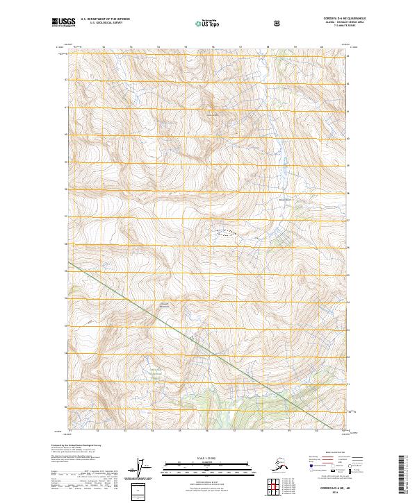
2024 Map of Cordova D-6 NE
USGS Topo · Published 2024About this map
Meteorite Mtn and the high ridges of the Chugach Mountains dominate this high-elevation wilderness within the Chugach National Forest. The landscape is defined by steep glacial topography, where Brown Basin serves as a primary drainage collection point for local waterways. Drainage patterns are established by the flow of Browns Creek in the north and Dead Creek toward the southern boundary. This map captures the uninhabited state of these mountain ranges in the early 21st century, showing a terrain largely untouched by modern infrastructure, preserved for its ecological and geological significance. The grid of the Public Land Survey System, including t10s r4w and t11s r5w, provides the only human-imposed structure over this natural expanse.
Find a feature on this map
10 named features on this map. Tap any name to fly to it.
Don’t see what you’re looking for? This feature index may not catch every label — zoom into the map to look around manually.
Map Details
Editions of this 2024 Cordova D-6 NE Map
This is the sole edition of this map. No revisions or reprints were ever made.
Other maps of this area

1948 · Cordova
USGS Topo · 1:250,000

1950 · Cordova D-5
USGS Topo · 1:63,360

1951 · Cordova
USGS Topo · 1:250,000

1951 · Cordova D-6
USGS Topo · 1:63,360

1951 · Valdez A-6
USGS Topo · 1:63,360

1952 · Valdez
USGS Topo · 1:250,000

1952 · Valdez A-6
USGS Topo · 1:63,360

1953 · Cordova D-5
USGS Topo · 1:63,360

1953 · Cordova D-6
USGS Topo · 1:63,360

1953 · Valdez A-5
USGS Topo · 1:63,360