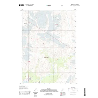
2018 Map of Cordova D-6 NW
USGS Topo · Published 2018About this map
Prince William Sound shoreline at the edge of the Chugach National Forest marks the southwestern boundary of this Alaskan coastal survey. The terrain is dominated by steep coastal elevation changes and intricate glacial runoff patterns typical of the region's geography. The map provides a detailed view of Solomon Gulch, a prominent drainage feature carving through the mountains toward the sound. Boundaries for Chugach National Forest, also indicated by its Cnf abbreviation, intersect with various section lines, illustrating the management of this public land. The network of contour lines reveals the complex vertical relief of the landscape, where unnamed peaks and ridgelines shape the watershed of the Valdez-Cordova Census Area.
Find a feature on this map
8 named features on this map. Tap any name to fly to it.
Don’t see what you’re looking for? This feature index may not catch every label — zoom into the map to look around manually.
Map Details
Editions of this 2018 Cordova D-6 NW Map
This is the sole edition of this map. No revisions or reprints were ever made.
Other maps of this area

1948 · Cordova
USGS Topo · 1:250,000

1950 · Cordova D-7
USGS Topo · 1:63,360

1951 · Cordova
USGS Topo · 1:250,000

1951 · Cordova D-6
USGS Topo · 1:63,360

1951 · Valdez A-6
USGS Topo · 1:63,360

1952 · Valdez
USGS Topo · 1:250,000

1952 · Cordova D-7
USGS Topo · 1:63,360

1952 · Valdez A-6
USGS Topo · 1:63,360

1953 · Cordova D-6
USGS Topo · 1:63,360

1959 · Cordova
USGS Topo · 1:250,000