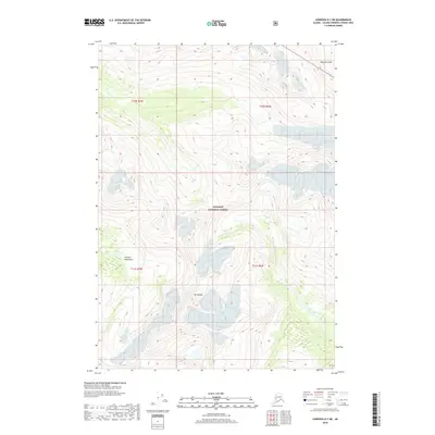
2018 Map of Cordova D-7 NE
USGS Topo · Published 2018About this map
Mt Denson dominates the high-altitude landscape of this area within the Chugach National Forest. The topography is characterized by the formidable peaks of the Chugach Mountains, where sharp elevation changes are recorded through dense contour mapping. In the northeast corner, Solomon Gulch cuts through the terrain, providing a natural drainage route from the glacial heights. This 2018 survey illustrates a wilderness largely defined by its natural barriers and public land boundaries, with township and range lines like t10s r7w and t11s r6w providing the only human-imposed structure across the expanse. The map serves as a primary reference for the intricate hydrology and glacial landforms of the Alaska-Valdez-Cordova region.
Find a feature on this map
8 named features on this map. Tap any name to fly to it.
Don’t see what you’re looking for? This feature index may not catch every label — zoom into the map to look around manually.
Map Details
Editions of this 2018 Cordova D-7 NE Map
This is the sole edition of this map. No revisions or reprints were ever made.
Other maps of this area

1948 · Cordova
USGS Topo · 1:250,000

1950 · Cordova D-7
USGS Topo · 1:63,360

1951 · Cordova
USGS Topo · 1:250,000

1951 · Cordova D-6
USGS Topo · 1:63,360

1951 · Valdez A-6
USGS Topo · 1:63,360

1952 · Valdez
USGS Topo · 1:250,000

1952 · Cordova D-7
USGS Topo · 1:63,360

1952 · Valdez A-6
USGS Topo · 1:63,360

1953 · Cordova D-6
USGS Topo · 1:63,360

1959 · Cordova
USGS Topo · 1:250,000