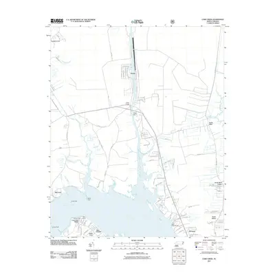
2011 Map of Core Creek
USGS Topo · Published 2011About this map
The Adams Creek Canal serves as a central artery through this coastal landscape, connecting northern waters to the Newport River. This 2011 survey documents the intricate interface of water and land in Carteret County, where established settlements like Core Creek and Seagate are surrounded by a network of tidal creeks and marshes. The map reveals a high density of residential developments along the southern shoreline, including Crab Point Village and Deer Field Shores, while the northern reaches maintain a more rural character around Craven Corner. For those studying local lineage, the Hardesty Cemetery is a significant waypoint situated north of Mill Creek. The inclusion of various private landings and basins, such as the Barge Landing Basin, illustrates the deep integration of maritime activity into the daily lives of these coastal communities.
Find a feature on this map
102 named features on this map. Tap any name to fly to it.
Don’t see what you’re looking for? This feature index may not catch every label — zoom into the map to look around manually.
Map Details
Editions of this 2011 Core Creek Map
This is the sole edition of this map. No revisions or reprints were ever made.
Other maps of this area

1949 · Beaufort
USGS Topo · 1:24,000

1949 · Merrimon
USGS Topo · 1:24,000

1949 · Newport
USGS Topo · 1:24,000

1949 · Williston
USGS Topo · 1:24,000

1949 · Harkers Island
USGS Topo · 1:24,000

1949 · South River
USGS Topo · 1:24,000

1949 · Mansfield
USGS Topo · 1:24,000

1949 · Cherry Point
USGS Topo · 1:24,000

1949 · Core Creek
USGS Topo · 1:24,000

1950 · South River
USGS Topo · 1:24,000