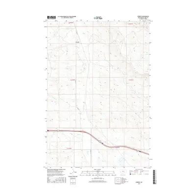
2017 Map of Corinth
USGS Topo · Published 2017About this map
Corinth sits at the heart of this Big Horn County landscape, where the high plains of Montana meet a network of seasonal and perennial drainages. The settlement's orientation is deeply tied to the local hydrology and the winding path of Fly Creek Rd, which serves as the primary north-south artery through the township. The terrain is defined by the dissection of several major waterways, including the meandering Fly Cr, Tenmile Cr, and Deer Cr to the north, while Hay Cr and Spring Cr carve through the southern sections. This 2017 survey reveals a landscape largely shaped by rural land divisions, with the township and range lines of t1n r30e and t1n r31e providing the structural framework for the ranches and homesteads that define this portion of the Montana interior.
Find a feature on this map
13 named features on this map. Tap any name to fly to it.
Don’t see what you’re looking for? This feature index may not catch every label — zoom into the map to look around manually.
Map Details
Editions of this 2017 Corinth Map
This is the sole edition of this map. No revisions or reprints were ever made.
Other maps of this area

1893 · Huntley
USGS Topo · 1:125,000

1894 · Fort Custer
USGS Topo · 1:125,000

1954 · Billings
USGS Topo · 1:250,000

1954 · Hardin
USGS Topo · 1:250,000

1957 · Hardin
USGS Topo · 1:250,000

1957 · Billings
USGS Topo · 1:250,000

1958 · Billings
USGS Topo · 1:250,000

1958 · Hardin
USGS Topo · 1:250,000
1967 · Wagon Box Spring
USGS Topo · 1:24,000

1967 · Nibbe
USGS Topo · 1:24,000