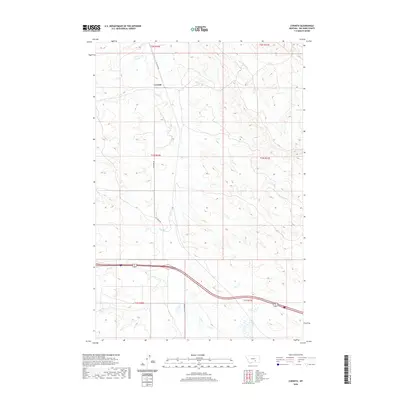
2020 Map of Corinth
USGS Topo · Published 2020About this map
Corinth sits along the upper reaches of Fly Cr in this rural expanse of Big Horn County. The landscape is defined by its drainage systems, where Tenmile Cr and Deer Cr carve through the terrain. A primary transportation artery, Fly Creek Rd, follows the winding course of the creek, providing a clear view of the rural infrastructure connecting this settlement to the surrounding ranching and agricultural lands. The southern portion of the quadrangle is marked by Spring Cr and Hay Cr, showing the intricate network of watercourses that have historically dictated the placement of roads and homesteads in this part of Montana. This topographic record emphasizes the enduring relationship between the drainage basins and the few established routes that traverse the Big Horn County hills.
Find a feature on this map
13 named features on this map. Tap any name to fly to it.
Don’t see what you’re looking for? This feature index may not catch every label — zoom into the map to look around manually.
Map Details
Editions of this 2020 Corinth Map
This is the sole edition of this map. No revisions or reprints were ever made.
Other maps of this area

1893 · Huntley
USGS Topo · 1:125,000

1894 · Fort Custer
USGS Topo · 1:125,000

1954 · Billings
USGS Topo · 1:250,000

1954 · Hardin
USGS Topo · 1:250,000

1957 · Hardin
USGS Topo · 1:250,000

1957 · Billings
USGS Topo · 1:250,000

1958 · Billings
USGS Topo · 1:250,000

1958 · Hardin
USGS Topo · 1:250,000
1967 · Wagon Box Spring
USGS Topo · 1:24,000

1967 · Nibbe
USGS Topo · 1:24,000