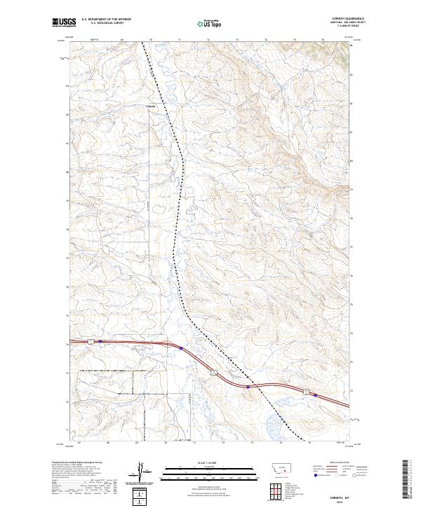
2024 Map of Corinth
USGS Topo · Published 2024About this map
Corinth sits along the upper reaches of Tenmile Creek in a landscape defined by the drainage systems of Big Horn County. This region is marked by a complex network of seasonal and perennial waterways, including Fly Creek, which flows northward through the center of the sheet, and Deer Creek to the east. The terrain is largely defined by the agricultural and ranching patterns of the early 21st century, where human imprint is most visible along Fly Creek Rd and the interstate corridor to the south. The southern edge of the map follows the winding path of Spring Creek, illustrating how the local geography dictates the placement of transportation routes and small-scale water management. This survey provides a clear view of the sparse settlement patterns and the topographic layout of the high plains, capturing the area before major modern developments might alter these traditional land use boundaries.
Find a feature on this map
13 named features on this map. Tap any name to fly to it.
Don’t see what you’re looking for? This feature index may not catch every label — zoom into the map to look around manually.
Map Details
Editions of this 2024 Corinth Map
This is the sole edition of this map. No revisions or reprints were ever made.
Other maps of this area

1893 · Huntley
USGS Topo · 1:125,000

1894 · Fort Custer
USGS Topo · 1:125,000

1954 · Billings
USGS Topo · 1:250,000

1954 · Hardin
USGS Topo · 1:250,000

1957 · Hardin
USGS Topo · 1:250,000

1957 · Billings
USGS Topo · 1:250,000

1958 · Billings
USGS Topo · 1:250,000

1958 · Hardin
USGS Topo · 1:250,000
1967 · Wagon Box Spring
USGS Topo · 1:24,000

1967 · Nibbe
USGS Topo · 1:24,000