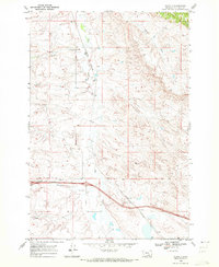
1969 Map of Corinth
USGS Topo · Published 1972About this map
Fly Creek and Tenmile Creek converge near the rail settlement of Corinth, anchoring a landscape defined by its riparian corridors and early transportation infrastructure. The Burlington Northern railroad runs north-to-south through this portion of Big Horn County, following the natural contours of the drainage systems. This 1969 field-checked survey captures the area at a point of modern transition, as the massive corridor of Interstate 90 cuts across the southern township line near Spring Creek.
Find a feature on this map
13 named features on this map. Tap any name to fly to it.
Don’t see what you’re looking for? This feature index may not catch every label — zoom into the map to look around manually.
Map Details
Editions of this 1969 Corinth Map
2 editions found
Other maps of this area

1893 · Huntley
USGS Topo · 1:125,000

1894 · Fort Custer
USGS Topo · 1:125,000

1954 · Billings
USGS Topo · 1:250,000

1954 · Hardin
USGS Topo · 1:250,000

1957 · Hardin
USGS Topo · 1:250,000

1957 · Billings
USGS Topo · 1:250,000

1958 · Billings
USGS Topo · 1:250,000

1958 · Hardin
USGS Topo · 1:250,000
1967 · Wagon Box Spring
USGS Topo · 1:24,000

1967 · Nibbe
USGS Topo · 1:24,000