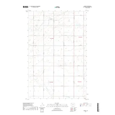
2017 Map of Corinth
USGS Topo · Published 2017About this map
Corinth stands as the primary settlement within this Williams County landscape, situated amidst a systematic grid of section lines and gravel roads. The terrain is defined by the winding course of the Little Muddy River in the southern portion of the quadrangle, which serves as the principal drainage for the surrounding prairie. This 2017 survey reflects the enduring rural character of northwestern North Dakota, where the land is meticulously partitioned into townships such as t159n r98w and t158n r98w. The map preserves the specific coordinates of local travel, from 83rd St NW at the northern boundary to the many numbered avenues that provide access to this agricultural heartland.
Find a feature on this map
22 named features on this map. Tap any name to fly to it.
Don’t see what you’re looking for? This feature index may not catch every label — zoom into the map to look around manually.
Map Details
Editions of this 2017 Corinth Map
This is the sole edition of this map. No revisions or reprints were ever made.
Other maps of this area

1911 · Ray
USGS Topo · 1:125,000

1948 · Alamo N.E.
USGS Topo · 1:24,000

1948 · Bright Water Lake
USGS Topo · 1:24,000

1953 · Williston
USGS Topo · 1:250,000

1957 · Williston
USGS Topo · 1:250,000

1974 · Wildrose
USGS Topo · 1:24,000

1974 · Tom Berg Lake
USGS Topo · 1:24,000

1977 · Alamo
USGS Topo · 1:24,000

1978 · Corinth
USGS Topo · 1:24,000

1978 · Epping NW
USGS Topo · 1:24,000